

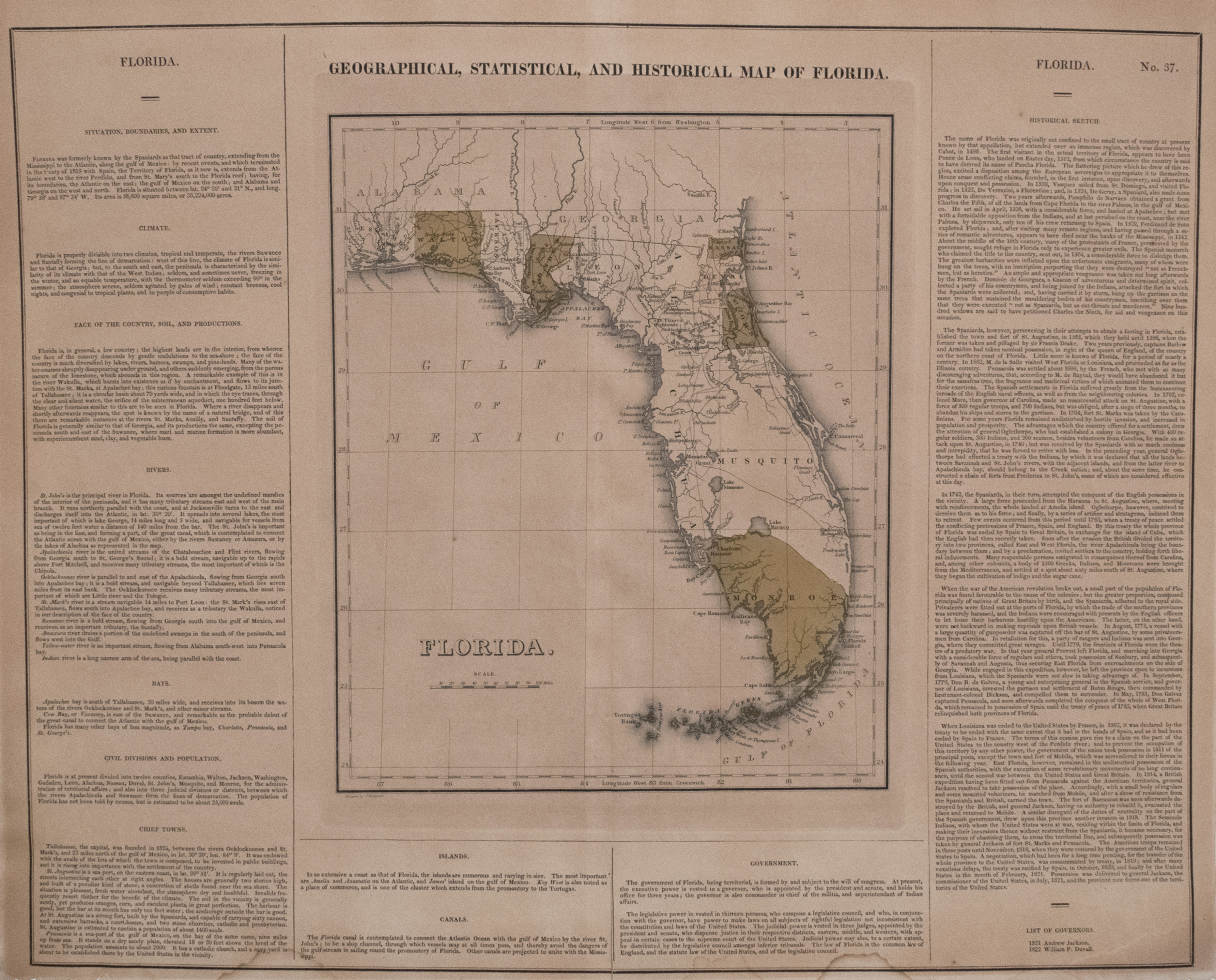
This is a rather scarce late edition of the Carey & Lea map series, in 1827. Florida Territory still only has 25K inhabitants and the capitol, Tallahassee, was just established in 1825. The map color codes the 12 counties, and offers a great deal of detail as to waterways and other topographical features as well as to the early settlements. Also, there is voluminous detail about Florida in three border areas -- climate, rivers, bays, population, history, and so on.
1827 Carey and Lea Florida Map
Title
Geographical, Statistical, and Historical Map of Florida
Map Maker Specifics
Carey & Lea, 1827, Philadelphia
Size
22 x 17.6 in. plus margins
Condition
Very Good to Good. Clear impression, hand colored. Noticeable toning throughout and two small damp stain areas in margin and partly into the narrative in lower left and right.