

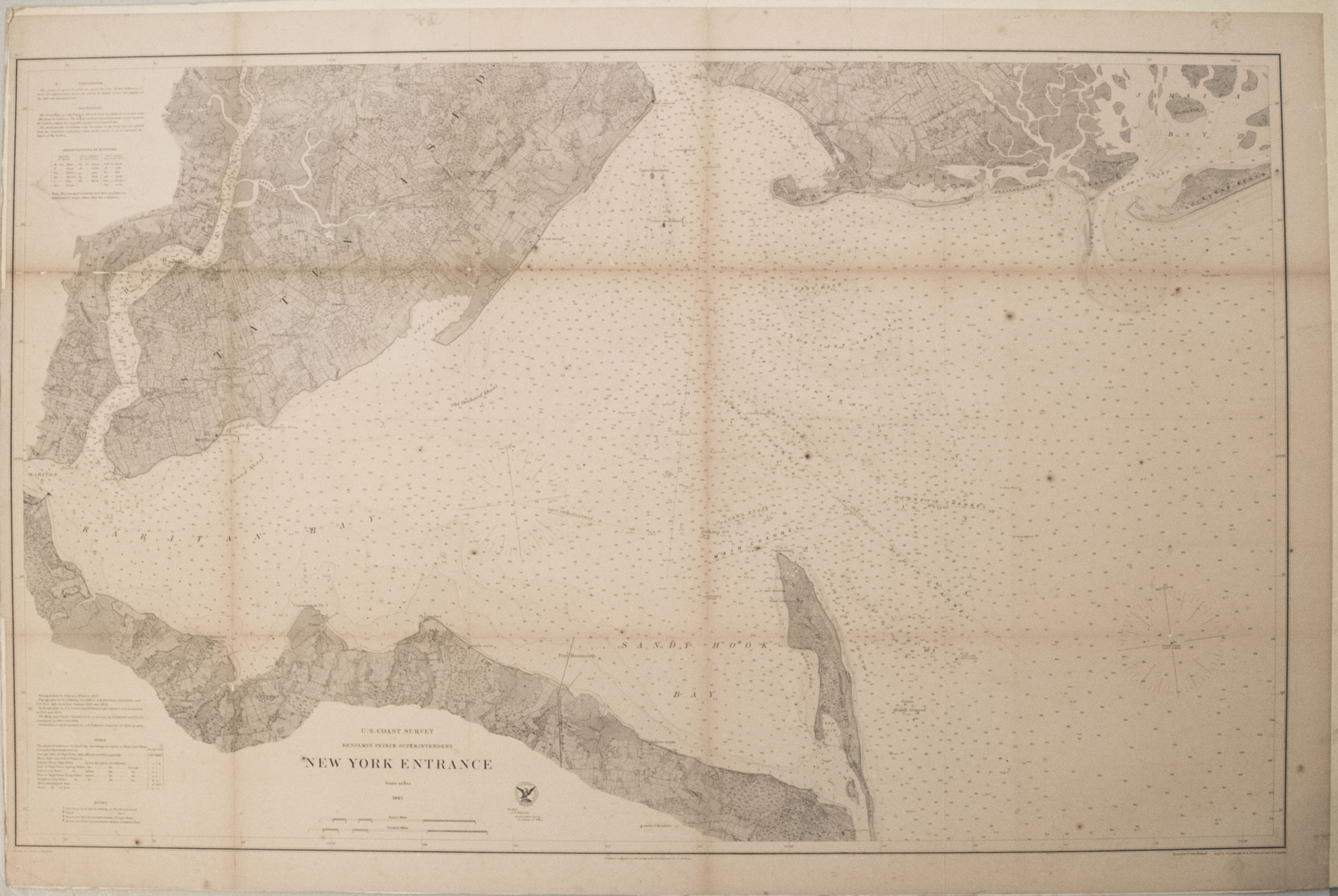
A very informative coastal survey chart showing the Southern portion of New York harbor area -- Sandy Hook to Staten Island, Perth Amboy, Brooklyn and Coney Island. Many soundings / water depths are shown as well as great deal of detail of the shores and the land. US Coastal survey chart, Benjamin Peirce superintendent.
1867 US Cost Survey Chart of Part of New York Entrance (Sandy Hook, Staten Is.)
SKU: 2478
$140.00Price
Title
New York Entrance
Map Maker Specifics
US Coast Survey, 1867
Size
24.2 x 39 in. plus margins
Condition
Very good - good. Modest toning, more in issued folds. Few foxing and discoloration spots. A few small splits and voids in folds. Mounted on board for easy framing.
)