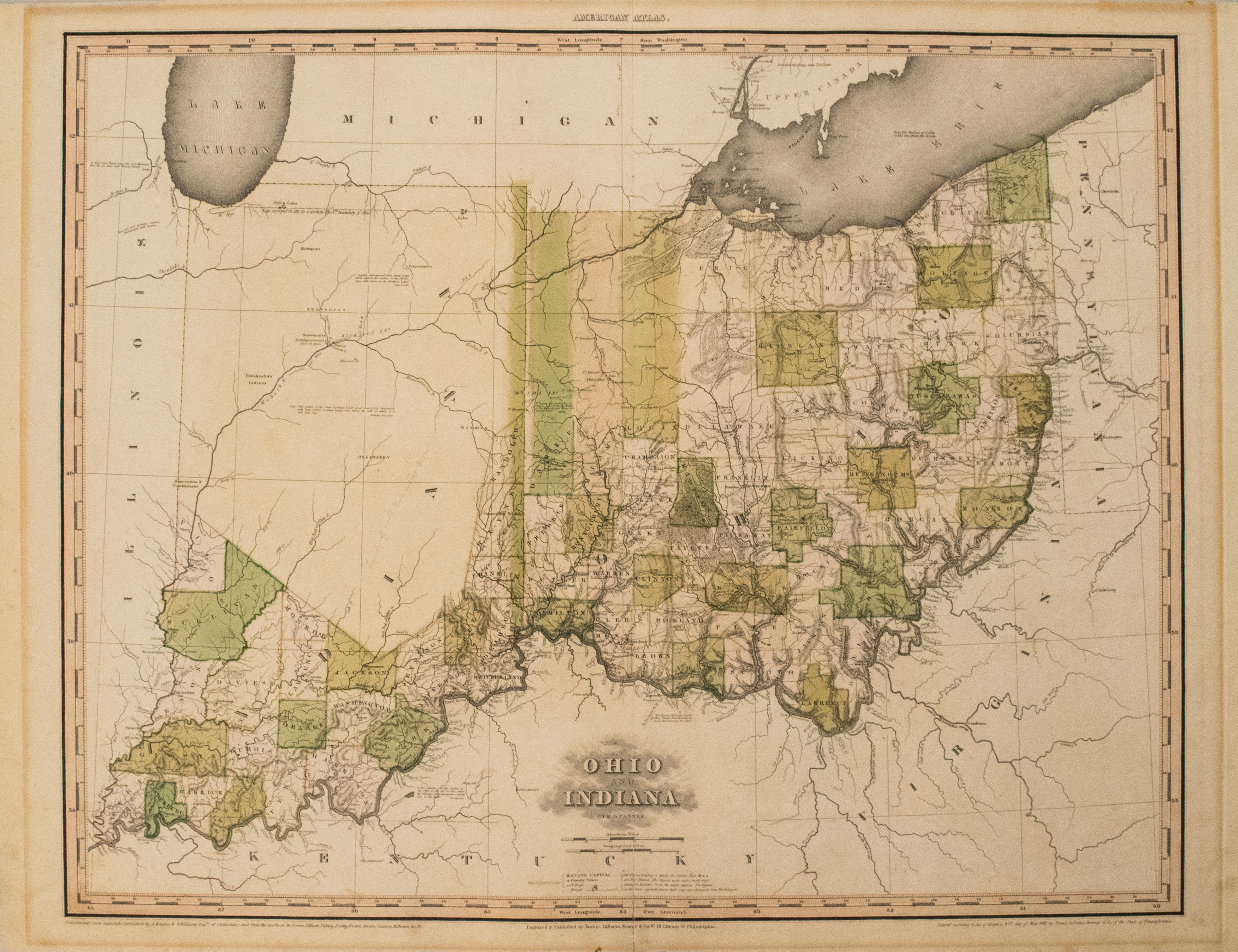
Wonderful colored and framed rare antique map of early counties of Indiana (southern) and Ohio. Indiana is not yet admitted as a state to the Union, and much of Indiana is unsettled and thus only the southern counties near the Ohio River have been established. Corydon is the center of government. Although Ohio is a state for 16 years, much of its northwest counties are not yet established. This map predates the land acquisition from Michigan, as the boundary shown is south of the Maumee River without the future port of Toledo.
1819 Tanner Early Map of Ohio and Indiana
Title
Ohio and Indianaa
Map Maker Specifics
H. Tanner, 1819, Philadelphia
Size
21.5 x 26.5 in. plus margins
Condition
Excellent-Very Good. Clean crisp impression and well colored map. Slight toning, and toned line outline in margins where previously was framed.


