

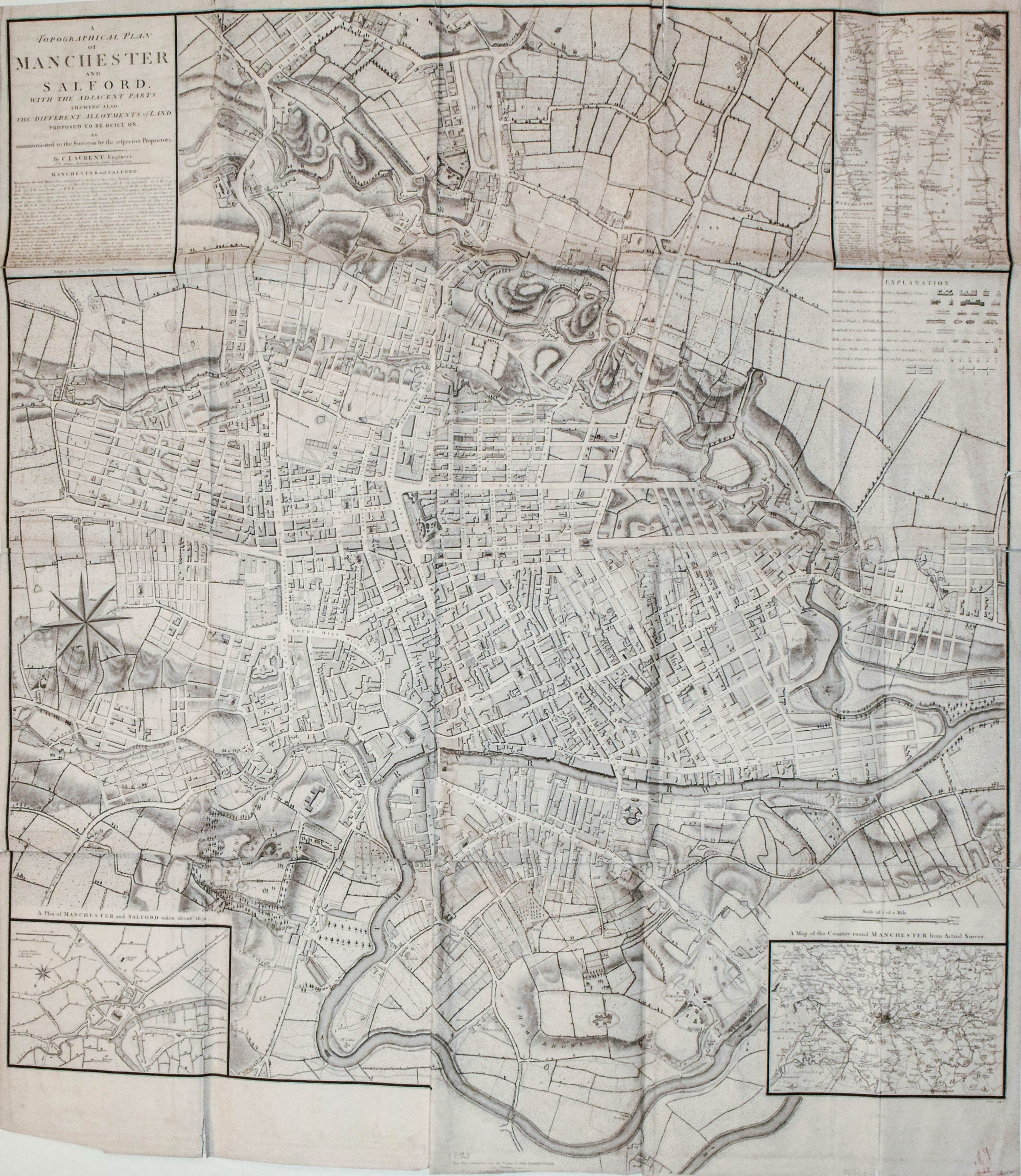
A very large magnificent map detailing Manchester and Salford, UK. The map also shows planned developments in the north east of the city. Inset is a plan of the city ca. 1650, the environs on Manchester, and a strip road map from London to Manchester. Engraved by J. Cary
1793 Laurent Large Map of Manchester, England
SKU: 2016
$700.00Price
Title
A Topographical plan of Manchester and Salford with the adjacent parts; shewing also the different allotments of land proposed to be built on as communicated to the Surveyor by the respective proprietors.
Map Maker Specifics
C. Laurent, 1793, London
Size
42 x 36.25 in.
Condition
Folded as issued. Minor tears and darkening in edges and folds. Not professionally backed at folds.