

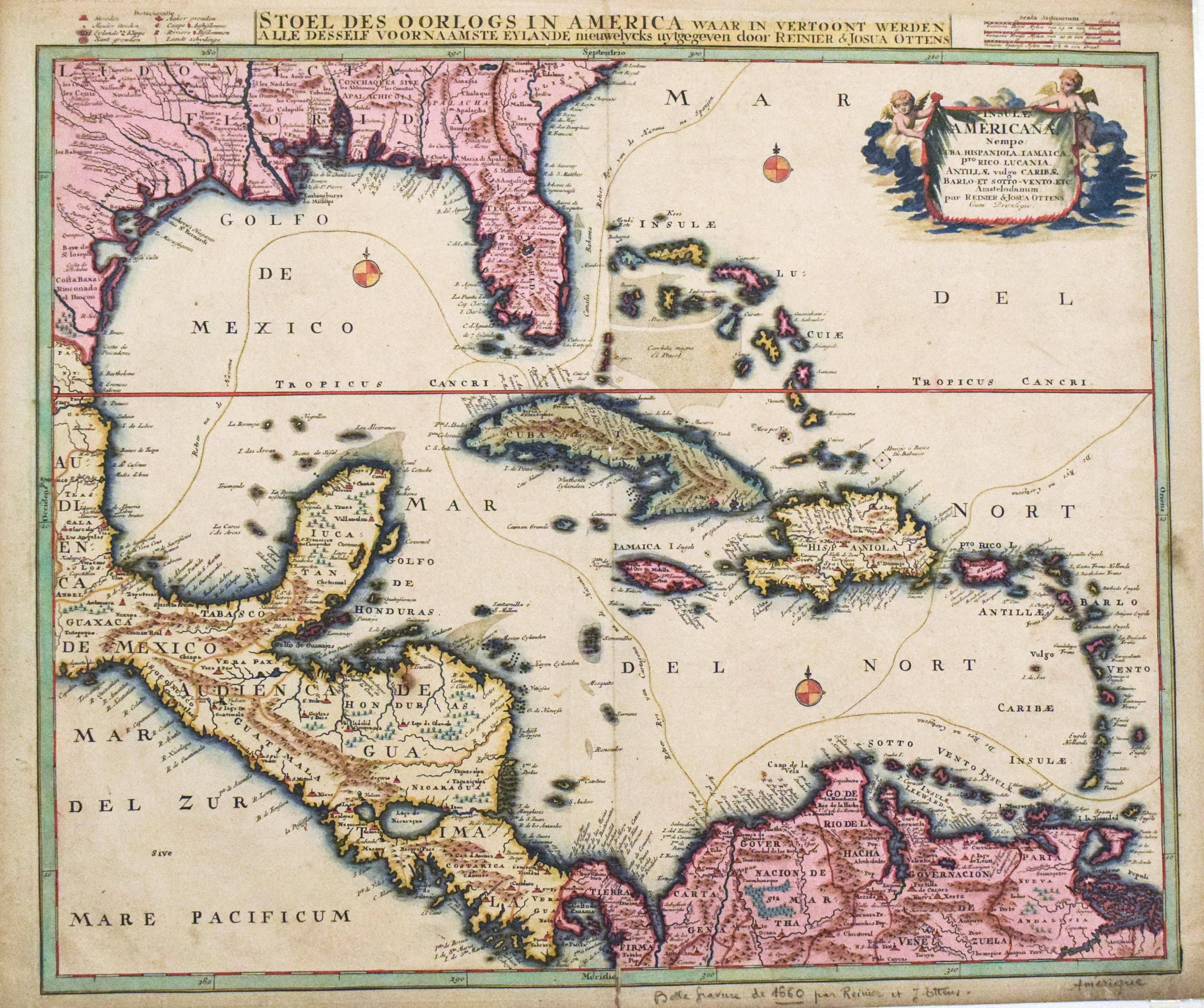
This highly attractive scarce map covers the West Indies / Caribbean region including Cuba, Jamaica, Hispaniola, etc. and also the future US’s southern states including Florida and Texas as well as much of Mexico and Central America. The map shows the routes of the Spanish silver fleets that departed from Cartagena de Indias and Veracruz and meet at Havana to set sail to Seville with all the silver and goods from West Indies and Philippines. The map comes from the atlases published by the Ottens brothers between 1720-50.
1730 Ottens Map of the Caribbean / West Indies
Title
Insula Americana nempe Cuba, Hispaniola, Jamaica, Pto Rico, Lucania,Antillae vulgo Caribe barlo et Soto vento ...
Map Maker Specifics
R. & S. Ottens, 1730 c., Amsterdam
Size
24.8 x 20.5 in. plus margins
Condition
Very good. Slight foxing, some finger soiling and toning mostly in the marging. A few very small pinholes and slight separation in the issued centerfold.