

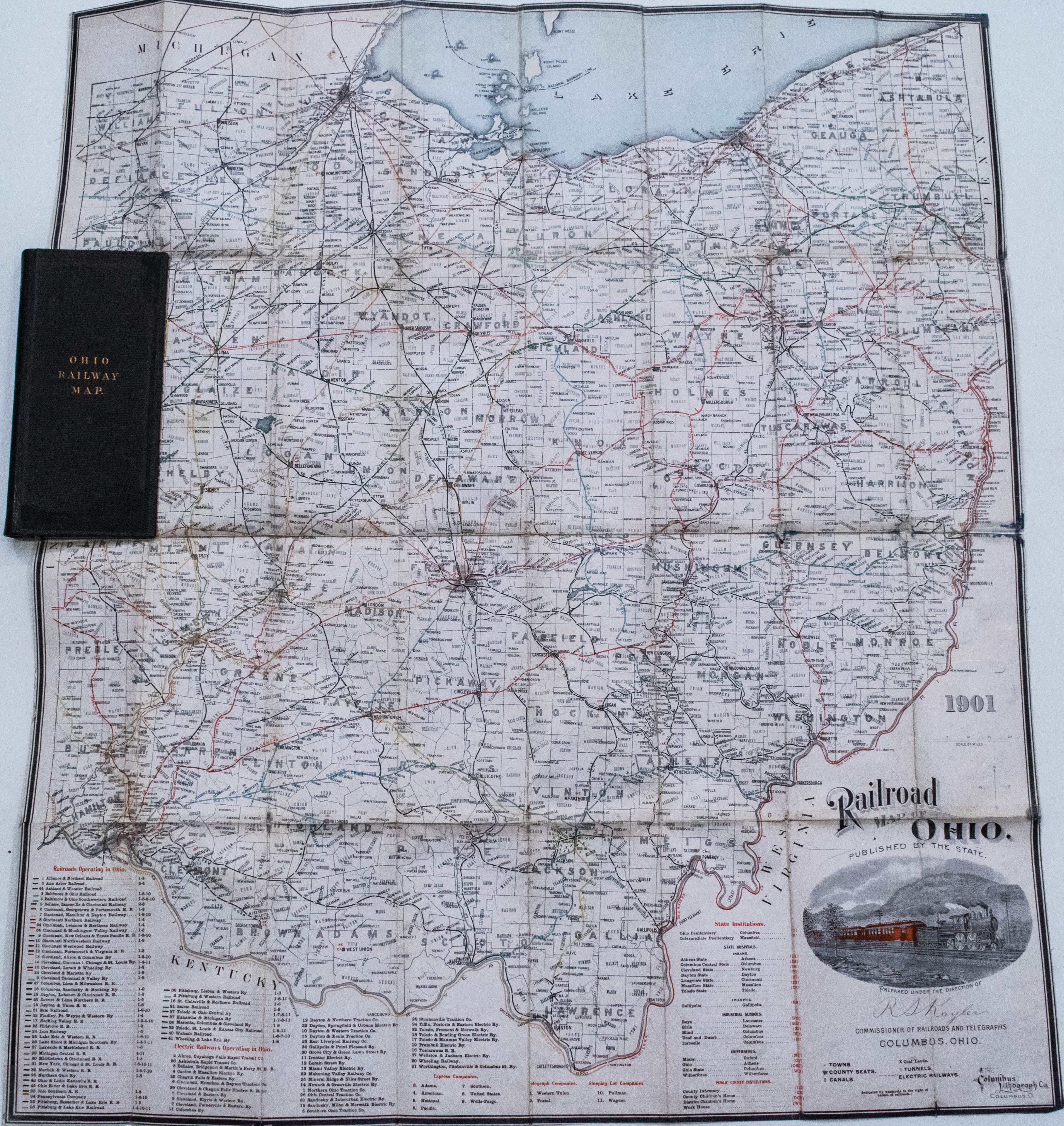
Large and nicely engraved map showing the railways of Ohio prepared by W.M. Kirkby, Commissioner of Railroads & Telegraphs. The 82 railroads in operation throughout Ohio are named and are color coded on the map. The electric railways, institutions, telegraph companies, express companies, etc. are noted as well. There is a lot of additional detail provided in towns, townships, counties, etc. The pictorial cartouche is of railroad locomotive and cars. Red over printed, concentric 25 mile circles indicate distances from Columbus at the center. The map is mounted on linen, as issued, and folds into gilt stamped hard covers.
1901 Ohio Railroad Pocket Map
SKU: 2233b
$140.00Price
Title
Railroad map of Ohio, Published by the State. Prepared under the direction of R.S. Kayler commissioner of railroads and telegraphs
Map Maker Specifics
R Kaylor / State of Ohio, 1901, Columbus
Size
32.25 x 28.5 in. unfolded, 8.3 x 4.25 in. case
Condition
Excellent case map. Slightly used in appearance. Slight ink stain in some verso corners, not coming through the map face. Linen mounted, as issued. Gild stamped hard cover in excellent shape.