

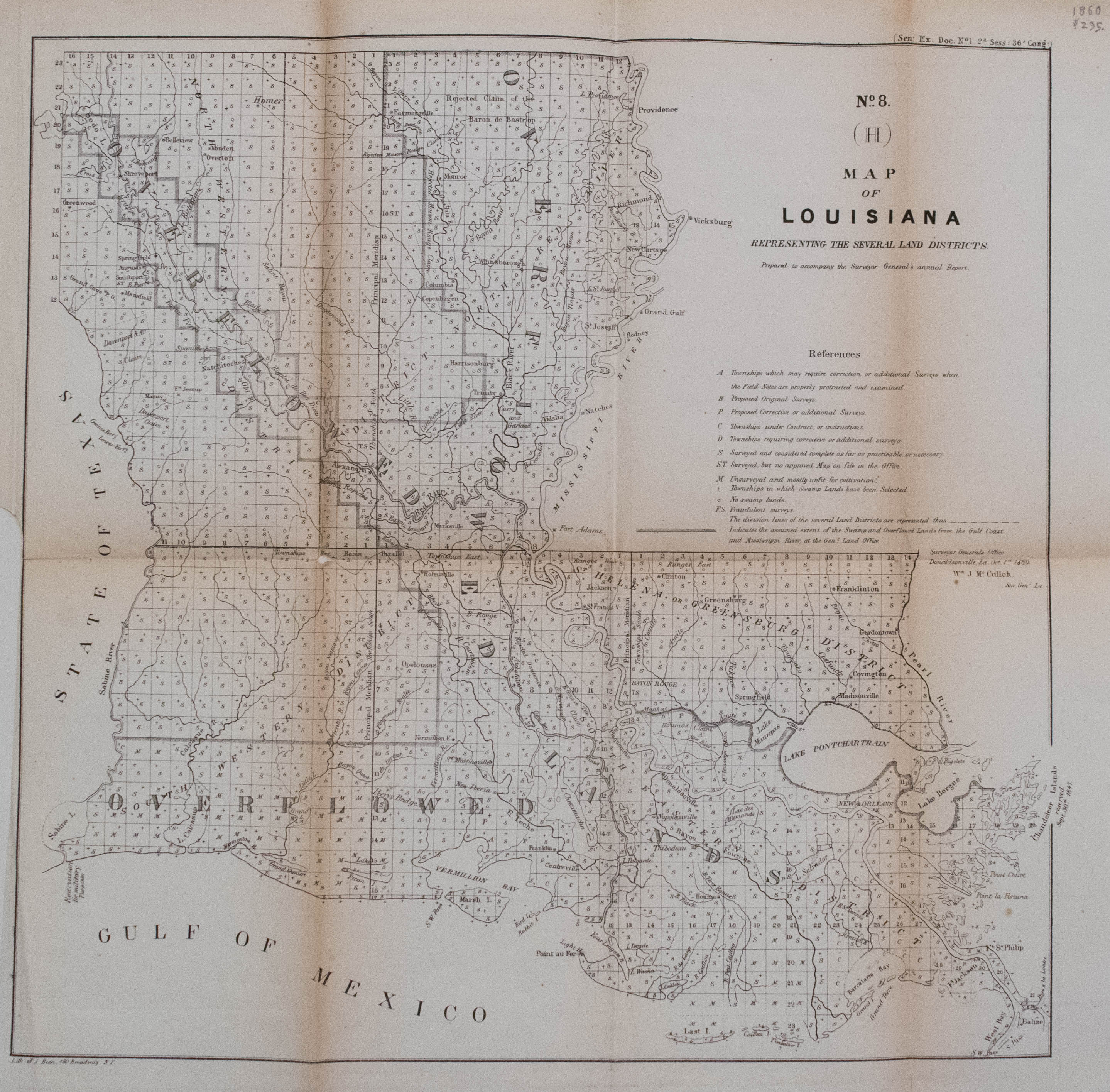
This Louisiana Surveyor's map shows grid system for public lands in Louisiana divided into townships, floodplains along the Gulf Coast, the Mississippi River and other tributaries; and land ownership in some cities and towns. It includes legend of "References" to symbols used on map. Scale is not given. Follows similar few years earlier maps by Boyd.
1860 Surveyor's Map of Louisiana
SKU: 2240b
$150.00Price
Title
No. 8 (H) Map of Louisiana Representing the Several Land Districts
Map Maker Specifics
W. McCulloh, 1860, New York
Size
15.5 x 16 in. plus margins
Condition
Very good. Uncolored. Some age toning throughout. Lower left margin cut to near neat line. Two small separations in issued folds.