

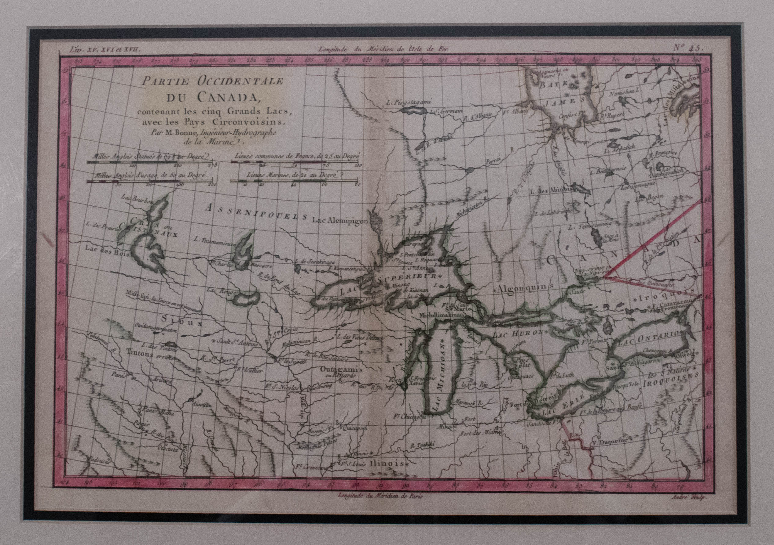
This French map is one of the most interesting maps of the Great Lakes. It maps the region from James Bay to just below Ft. Duquesne (today's Pittsburgh) and from Lake Ontario well into the Great Plains. Many Indian tribes (Iroquois, Illinois, Sioux, etc) and forts including Detroit, St. Louis, Toronto and Chicagou, fur trade routes and missions are shown. Lake Superior contains Isle Royale, as well as the phantom islands of St. Anne, Maurepas and Ponchartrain, which were reported by the Jesuit explorer Charlevoix. The source of the Mississippi is shown but is noted as inconnu or unknown. Engraved by Andre. Hand colored and matted.
1880 Bonne Map of the Great Lakes
SKU: 2138
$300.00Price
Title
Partie Occidentale du Canada, contenant les cinq Grands Lacs, avec les Pays Circonvoisins
Map Maker Specifics
R. Bonne, 1780, Paris
Size
8.3 x 12.5 in. plus margins
Condition
Very good example. Issued centerfold is noted and is slightly age toned. Hand color outlines and is matted.