

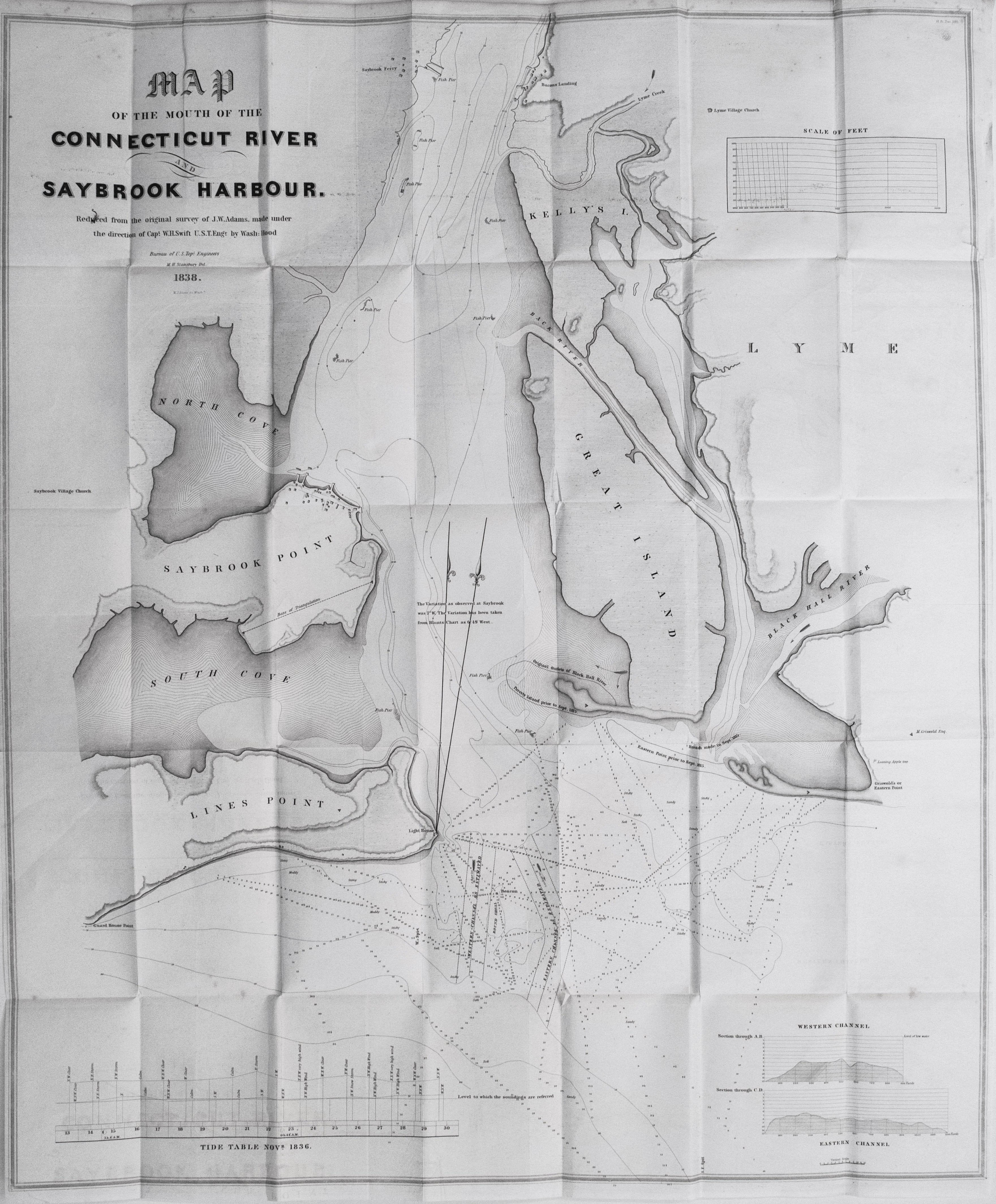
Large rare, engraved antique map showing nice details of the waters in the vicinity od Saybrook. The coastal features are well defined and there is a street grid for Saybrook. The lighthouse is clearly shown on the western side of the mouth of the Connecticut River. At Griswold's or Eastern Point a single apple tree is drawn and labeled "Leaning Apple". This map is a reduced version of the survey map by J.W. Adams.
1839 Map of Connecticut River and Saybrook Harbor
SKU: 2187
$200.00Price
Title
Map of the Mouth of the Connecticut River and Saybrook Harbour. Reduced from the Orginal Survey of J.W. Adams. Made under the Direction of Capt. WH Swift
Map Maker Specifics
US Government, 1839
Size
24.5 x 29 in. plus margins
Condition
Near Fine, a touch of offset, uncolored; Folds as issued. Good impression on thick paper.