

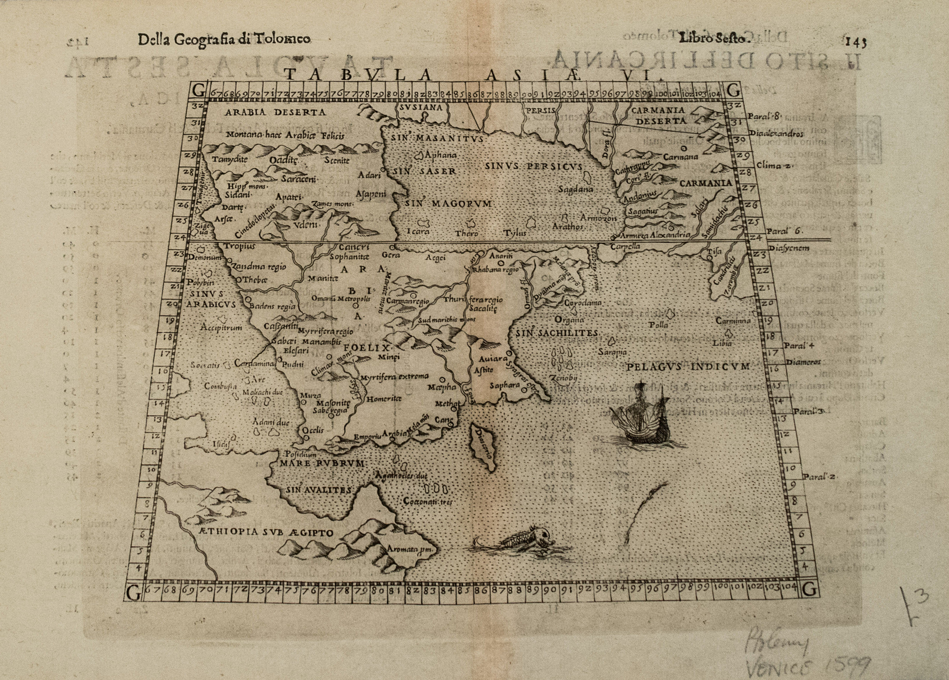
This is a handsome map centered around the Arabian Peninsula and the Persian Gulf with Ethiopia and Somalia also shown in part. The Red Sea and Gulf of Adan fairly accurate. Details shown include topography, settlements, many rivers and islands, with many being imaginary. This example is the third state of the map, which was first published in 1561 and revised in 1574. This, the final 1598 edition which is re-engraved and revised to include a Sea Monster and Sailing Ship is much scarcer than its predecessors.
1598 Ruscelli Map of the Arabian Peninsula
SKU: 2661d
$400.00Price
Title
Tabula Asiae VI
Map Maker Specifics
G Ruscelli, 1798, Venice
Size
7.1 X 9.3 in. plus margins
Condition
Very good. Clear strike on watermarked laid paper. Slight discoloration in the issued centerfold. Italian text on verso.