

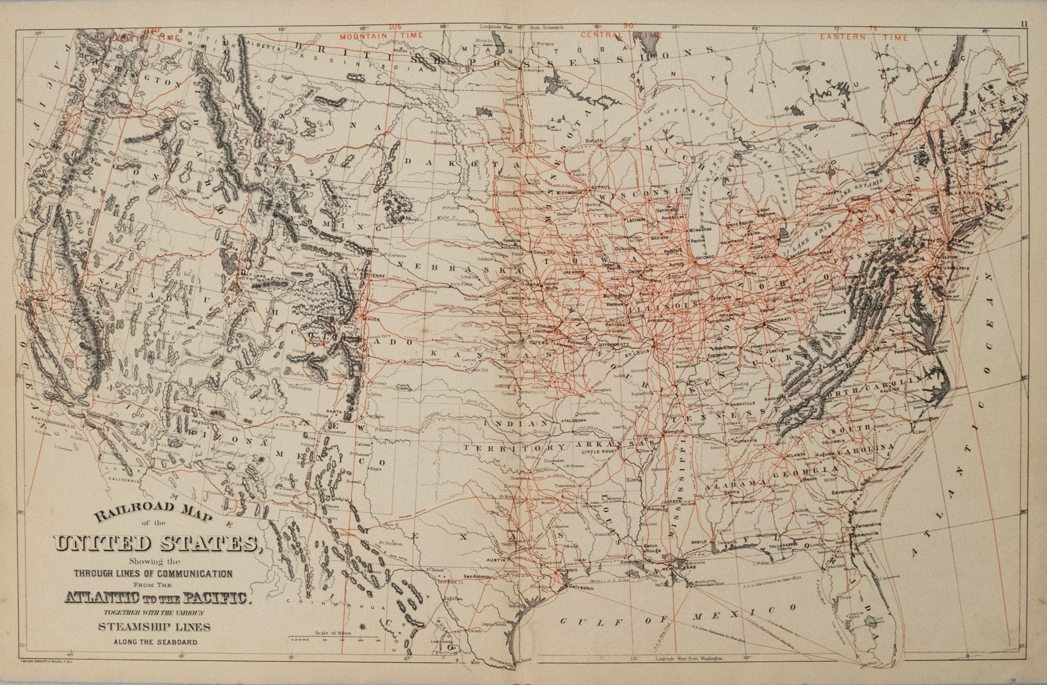
This is a superb map showing the railroads with bold red over-printing. State & territory boundaries are depicted along with major cities, forts and mining communities. Steamship routes and time zones, new to the day, are also displayed. This map is without the often seen Mitchell decorative border. Published by W. Bradley & Bros.
1887 Mitchell Railroad Map of the United States
SKU: 2555h
$220.00Price
Title
Railroad Map of the United States, Showing the through Lines of Communication from the Atlantic to the Pacific. Together with the Various Steamship Lines along the Seaboard
Map Maker Specifics
S Mitchell, 1887, Philadelphia
Size
14.2 X 22.6 in. plus margins
Condition
Very Good. Very slight toning. Colored. Issued centerfold.